0. 기본 - 위도경도 좌표계 (WGS84 - EPSG:4326)
1. TM좌표계 (ex: http://www.localdata.kr/, data.nsdi.go.kr/dataset)
+proj=tmerc +lat_0=38 +lon_0=127.5 +k=0.9996 +x_0=1000000 +y_0=2000000 +ellps=GRS80 +units=m +no_defs +type=crs혹은
+proj=tmerc +lat_0=38 +lon_0=127.0028902777778 +k=1 +x_0=200000 +y_0=500000 +ellps=bessel +units=m +no_defs +towgs84=-115.80,474.99,674.11,1.16,-2.31,-1.63,6.432. UTM-K (EPSG:5178)
+proj=tmerc +lat_0=38 +lon_0=127.5 +k=0.9996 +x_0=1000000 +y_0=2000000 +ellps=bessel +units=m +no_defs +towgs84=-115.80,474.99,674.11,1.16,-2.31,-1.63,6.433. KATEC 카텍좌표계
+proj=tmerc +lat_0=38 +lon_0=128 +k=0.9999 +x_0=400000 +y_0=600000 +ellps=bessel +units=m +no_defs +towgs84=-115.80,474.99,674.11,1.16,-2.31,-1.63,6.43
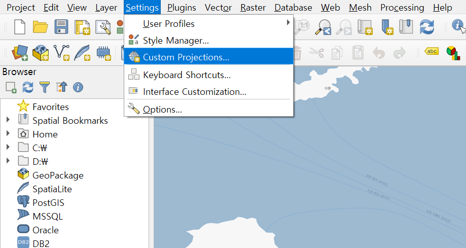
QGIS 활용시 (버전 3.10 기준):


Python 기준 (활용예시):
import geopandas as gpd
gdf = gpd.read_file("Z_NGII_N3A_G0010000/Z_NGII_N3A_G0010000.shp", encoding="euc-kr")
gdf.crs = "+proj=tmerc +lat_0=38 +lon_0=127.0028902777778 +k=1 +x_0=200000 +y_0=500000 +ellps=bessel +units=m +no_defs +towgs84=-115.80,474.99,674.11,1.16,-2.31,-1.63,6.43"
ngdf = gdf.to_crs("epsg:4326")
'GIS Tech > GIS Data Process' 카테고리의 다른 글
| 생활인구 시각화 (0) | 2021.01.22 |
|---|---|
| Python (GIS+General) Tip 모음 (5) | 2021.01.11 |
| 지도상 영역의 GeoJSON Polygon 생성 웹앱 만들기 (Python) (0) | 2021.01.10 |
| WMS 를 이용하여 TOPIS 교통 링크 지도데이터 얻기 (2) | 2021.01.08 |
| Instagram Crawling by shortcode (0) | 2021.01.08 |


댓글