blog.mapbox.com/visualizing-street-orientations-on-an-interactive-map-1eefa6002afc
Visualizing street orientations on an interactive map
Cities can look and feel very different depending on how they were planned and built, and this is especially apparent when you explore them…
blog.mapbox.com
원글은 다음과 같고, github코드가 공개되어있다.
github.com/mourner/road-orientation-map
mourner/road-orientation-map
A visualization of road orientations on an interactive map - mourner/road-orientation-map
github.com
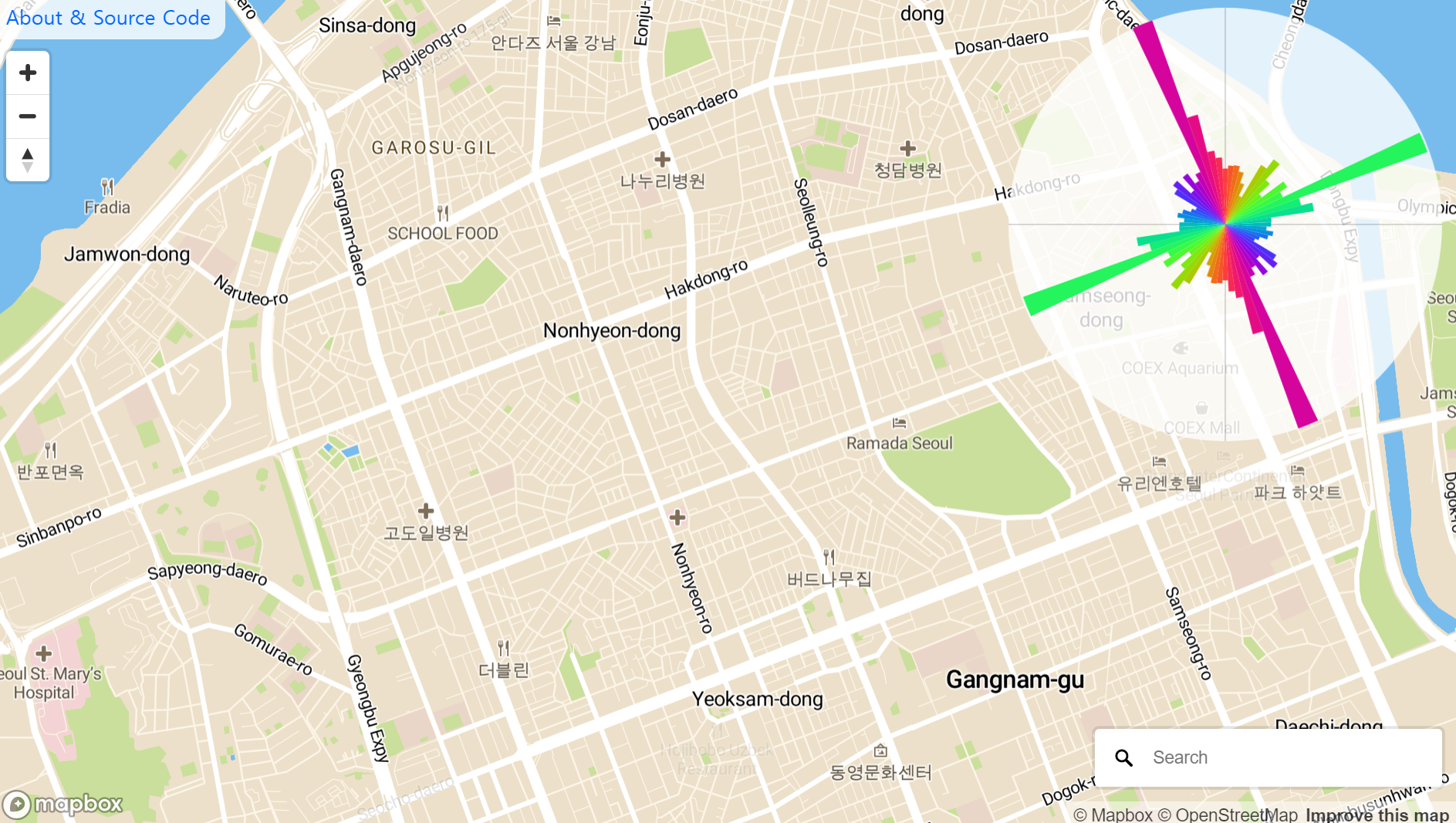
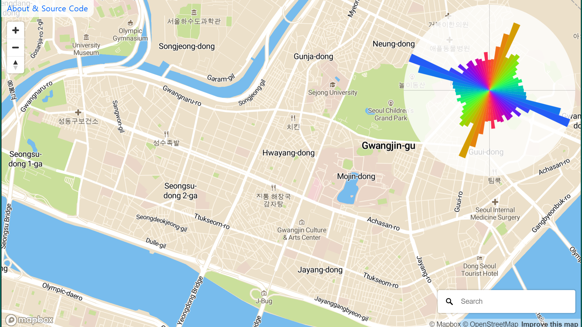

굉장히 창의적인 시각화라고 생각된다.
이 시각화에서 엔트로피 같은걸 계산해서 얼마나 도로가 정렬되어있는지 수치화 하는것도 가능하지 않을까 생각이든다.
'Research (Public Post)' 카테고리의 다른 글
| 금강경 원문 (0) | 2021.03.07 |
|---|---|
| 박사학위 길잡이 (Estelle M. Phillips, Dered S. Pugh 저) (0) | 2021.01.29 |
댓글